-View the North Dakota Risk Assessment Map Service (NDRAM) site to display current flood risks, water surface elevations, and more information on your property: https://ndram.swc.nd.gov/
-Take Steps to prepare for flooding such as understanding flood insurance: https://www.floodsmart.gov/
-North Dakota State University Publication: Sandbagging for Protection May 2018
National Weather Service Homepage for flood alerts: https://www.weather.gov/bis/
James River Hydrographs and levels:
NWS - James River at LaMoure Hydrograph
USGS - James River at LaMoure gage height, discharge and precipitation data
USGS - James River near Adrian gage height
HEFS - 10 Day River Level Probability for James River at LaMoure
North Dakota Department of Water Resources LaMoure County
PRESENS units - (data available for Boom and Twin Lakes)
The link below will take show the water control information for the Omaha District, US Army Corps of Engingeers. Go to the "Bulletins" and then "Daily Bulletin" to see an update of inflows and outflows of the projects. This is updated hourly.
Update: May 16, 2023: An additional thunderstorm over the weekend has further increased inflows into both Jamestown and Pipestem reservoirs. To manage the storage as prescribed in the Water Control Manual, combined releases are being increased to 1,600 cfs this week. Pipestem increased 100 cfs to 500 cfs on Monday. Jamestown will increase 100 cfs Tuesday and another 100 cfs Wednesday to reach 1,100 cfs from Jamestown and a combined release of 1,600 cfs.
https://www.nwo.usace.army.mil/Missions/Water-Information/Water-Control/
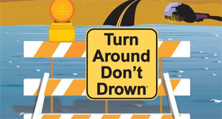 Turn Around - Don't Drown
The Centers for Disease Control and Prevention report that over half of all flood-related drownings occur when a vehicle is driven into hazardous flood water. The next highest percentage of flood-related deaths is due to walking into or near flood waters. People underestimate the force and power of water. Never drive around the barriers blocking a flooded road. The road may have collapsed under that water.https://www.weather.gov/safety/flood-turn-around-dont-drown
In 2019, the LaMoure gage reached two record levels: On October 26, 2019, the gage reached 15.12ft and 5350cfs. On April 4, 2019, the LaMoure gage reached a peak of 15.95ft.
(1) 17.56 ft on 04/15/2009
(2) 16.52 ft on 03/27/2009
(3) 16.20 ft on 05/24/1969
(4) 16.17 ft on 04/14/1969
(5) 16.09 ft on 04/01/1997
(6) 15.95ft on 04/04/2019
(7) 15.80 ft on 03/21/2010
(8) 15.34 ft on 05/16/1950
(9) 15.12 ft on 10/26/2019
(10) 14.85 ft on 03/21/1966
Major flood stage 18ft
Moderate flood stage 16 feet ~ 7,530 cfs
Flood stage 14.0 feet ~ 3,880 cfs
Action stage 12.0 feet ~ 2,690 cfs
Average level 7 to 8 feet